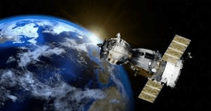
With the hope of providing water resource managers with better tools to help keep aquifers healthy, a team of scientists from ASU and the Jet Propulsion Laboratory (JPL) are using the latest space technology to look underneath Earth’s surface to measure this precious natural resource. They’ve focused their efforts on one of the world’s largest aquifer systems, located in California’s Central Valley, measuring both its groundwater volume and its storage capacity.
Using these high-tech remote sensing techniques, the team analyzed data from the 2007 to 2010 drought period and began to map the entire California Central Valley. They measured land subsidence (when land above and around an aquifer shifts downward) using space-borne Interferometric Synthetic Aperture Radar (InSAR) and added that to data on groundwater levels sampled at thousands of wells across the Central Valley.
The next steps for this team will be to focus on the period of drought in California from 2012 to 2016, which was even more detrimental to the Central Valley aquifer than the 2007 to 2010 drought period. And the work will not end there. The research team hopes to extend the research they are doing in California to Arizona and other areas of the arid southwest.
Date: July 19, 2018
Image: Google Images
Coordinator: EnvGuide Team (Mengxi Tan, Yicheng Huang, Yuying Chen)
Source: https://www.sciencedaily.com/releases/2018/07/180719112217.htm
